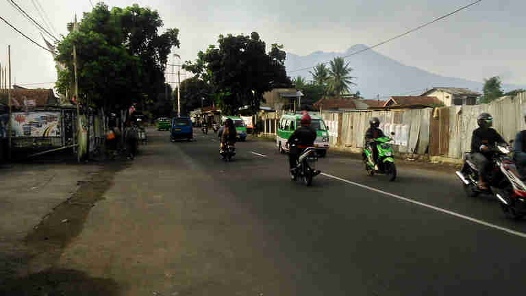
As written on my previous writing about the short description of Bogor, this rain city is located in mountainous area. It is surrounded by three mountains, Mount Salak, Mount Pangrango and Mount Gede.
The nearest one to the city is the Mount Salak. It can be said that the city has been built on the foot of the mountain.
It is also the reason why on every badge of public civil servants in Bogor, there is a silhouette of this mountain. The city and its people consider the mountain as the icon.
The description of Mount Salak
The name – Many people including people who are born in Bogor wrongly relate the name of this mountain to a name of tropical fruit “Salak”(Salacca zalacca) or known also as snake fruit.
The actual meaning of the name is far away from what people think. The name is taken from Sanskrit language. The meaning is “Silver”.
The Mount Salak is a vulcano.The height is 2,211 M from sea level and it is considered as a Strato A or low level volcano.
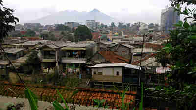
The history recorded several eruption from this mountain. The first record mentioned a big eruption occurred back in 1699. Many casualties and damage were resulted. Several other eruptions were also written in 1761 and 1780.
Another earthquake caused by the volcanic activity in 1834 severely damaged the Buitenzorg mansion or Governor Palace at that time, now known as Bogor Palace.
There were still many other eruptions happened after that.
(However I am lucky that since I started my living in Bogor, I never experienced the anger of the silver mountain)
——–
The mountain presents also in many mythologies related to Bogor. It is believed that the King of Sunda Kingdom whose capital , said to be in Bogor, Prabu Siliwangi disappeared (moksha) somewhere on the mount Salak. Even the establishment of Parahyangan Agung Jagatkartta Temple, a Hinduism temple is said to be on the place where Prabu Siliwangi vanished.
Many mountain climbers have become victims when they try to climb to its top. The story of mouth spread that it was caused by the anger of the watchman of the mountain.
The last case of the plane accident of Sukhoi Superjet 100 that took 45 lives were also connected to this Silver Mount. It was not the first time of flight accident because before that a helicopter fell during a flight over the mountain . Due to these accidents, more people believe that the area surrounding the mountain is like the Bermuda Triangle.
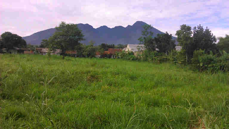
You can believe it .. or not. It will be up to you.
What I know for sure that this mountain is beautiful. I meant even from the city, its figure can be seen. Sometimes fog wraps its top, many times cloud is like hanging to its gallant posture .
Many lovely natural spots can also be found in the surrounding area. Some waterfalls, few creeks and rivers can be seen there. Forest are still thick until now.
Unfortunately, the growth of Bogor has also given impact to the silver mountain. It is no longer easy to see the figure from the city. People in Bogor accustomed to be able to see its figure from any corner of the city. This can not be done again nowadays. The view of mount Salak was shut in behind the multi-storey building.
The developments of many housings have also sacrificed some forest and land nearby. Beautiful landscapes have been getting difficult to find. Furthermore the capitalism has caused establishment of hotels and resorts on the area. Several waterfalls has fallen victims due to this as it is built into an amusement park. The destruction of the nature seems
Too bad..
I am just hoping that the Mount Salak, the Silver Mountain will not be angry with us in future due to this. (Hey, I become superstitious..)

![[PHOTO] A Street Portraitist on Juanda Street Still Exist](https://lovelybogor.com/wp-content/uploads/2023/09/PHOTO-Street-Portraitist-on-Juanda-Street-Still-Survives-330x220.jpg)
![[PHOTO] How Subsidized LPG (Liquid Petroleum Gas) Distributed in Bogor?](https://lovelybogor.com/wp-content/uploads/2023/09/How-Subsidized-LPG-Distributed-in-Bogor-330x220.jpg)
![[PHOTO] No Longer Just A Town, Bogor is a Metropolis](https://lovelybogor.com/wp-content/uploads/2023/09/No-Longer-Just-Town-Bogor-is-a-Metropolis-330x220.jpg)
![[Photo] The East Side, The Old Parts of Bogor Commuter Train Station](https://lovelybogor.com/wp-content/uploads/2022/09/The-old-part-of-Bogor-Commuter-Train-StationIMG_4233-330x220.jpg)
![[Photos] Old Machine Guns From Indonesian Independence Era – Bogor Perjuangan Museum](https://lovelybogor.com/wp-content/uploads/2022/09/Old-Machine-Guns-From-Indonesian-Independence-Era-Bogor-Perjuangan-Museum-3-330x220.jpg)
![[Photos] Two Landmarks of Bogor City – Kujang Monument and The Nine Gates](https://lovelybogor.com/wp-content/uploads/2022/09/Photo-Two-Landmarks-of-Bogor-City-Kujang-Monument-The-Nine-Gates-330x220.jpg)
saya seorang peneliti, now sedang jauh di samudera hindia, ikut kapal norwegia. iseng2 baca blog anda, sangat menarik! tolong kalau bisa,untuk setiap ulasan yg melibatkan lokasi, di kasih dong snapshoot lokasi tepatnya di/dari googleMap, sehingga pembacabisa langsung dapat gambaran/orientasi lokasi yg sedang di bahas. Thanks..! *duan **ps: selesai project dgn Kapal Norwegia ini saya berencana cari lahan tanah mungil untuk berkebun di kaki Gunung Salak..
OK deh.. saya akan coba memenuhi usul bagus ini. Kalau mas sudah selesai tugas di kapal dan mau jalan-jalan di Bogor, silakan hubungi saya deh.. kita bisa jalan-jalan di Bogor bareng.